History of Mt. Hebo

 From military base to campsite
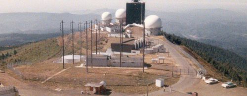
Today, few traces remain of Mt. Hebo’s days as a Cold War-era U.S. military station.
However, from 1956 until 1980, Mt. Hebo was home to a U.S. Air Force General Surveillance Radar Station, a long-range radar installation, with 4,000 people serving there over the years. The purpose of the station, which worked in conjunction with McChord Air Force Base in Washington, D.C., was to prevent the USSR from attacking the region by air.
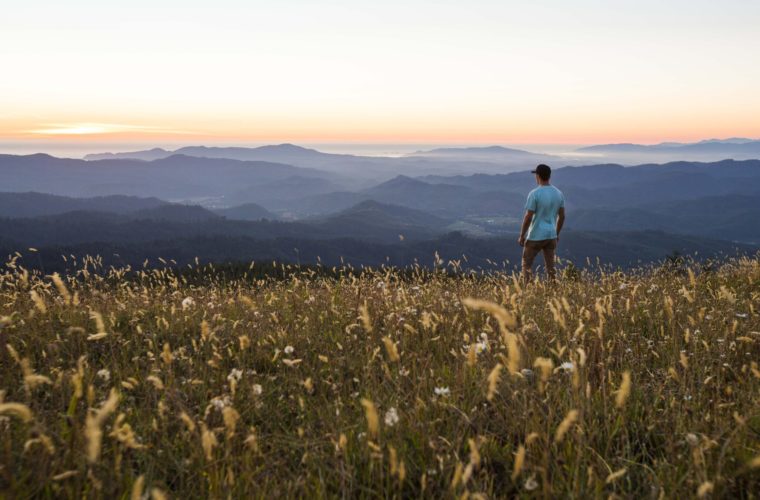
These days, as part of the Siuslaw National Forest, the 3,100-foot-tall mountain is better known for its camping, hiking, horseback riding and fishing opportunities, not to mention its views. None of the Air Force buildings remain.
Part of the Coast Range, Mt. Hebo straddles the Tillamook and Yamhill County lines and offers 360-degree vistas from its summit, which is accessed by an 8-mile forest service road from the community of Hebo. The U.S. Forest Service, which occupies offices at the base of the mountain, manages the area.