Parks
The Oregon Coast is known for its great parks, and we have the best ones. (Yes, we’re partial!). If one is crowded, there’s another park just a short distance away where you can find solace.
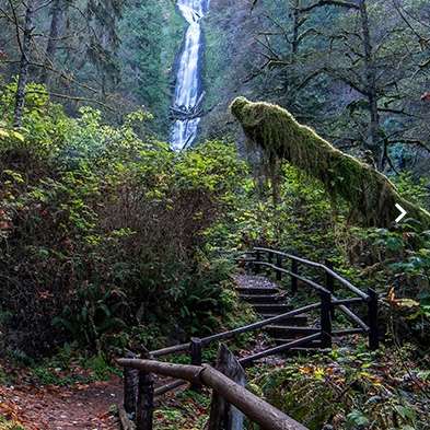
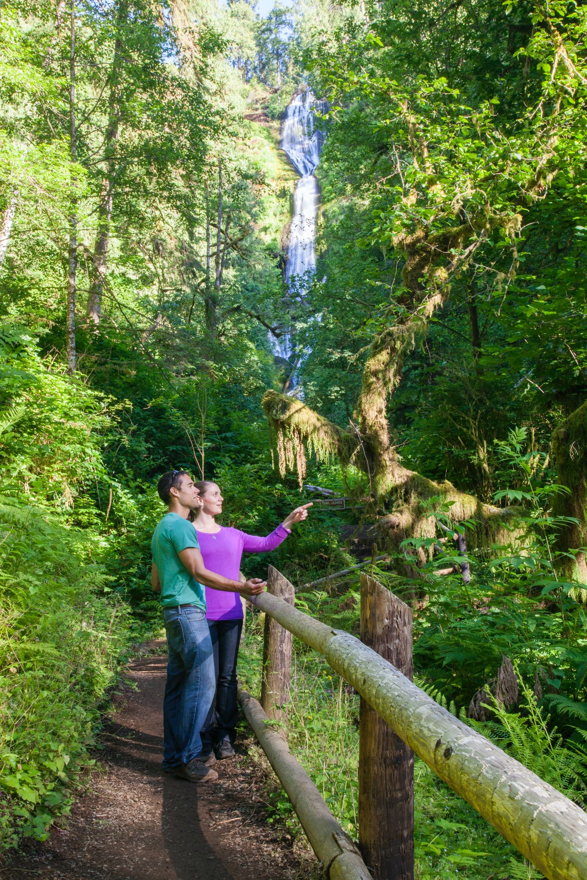
Tumbling 319 feet, Munson Creek Falls is the tallest waterfall in the Coast Range. A short trail through old growth forest leads to a view of the falls, and along the way you’ll see trillium, corydalis and violets nestled along the ground. Munson Creek is an important salmon habitat for spawning. Open year-round.

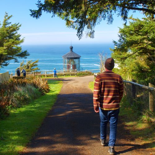
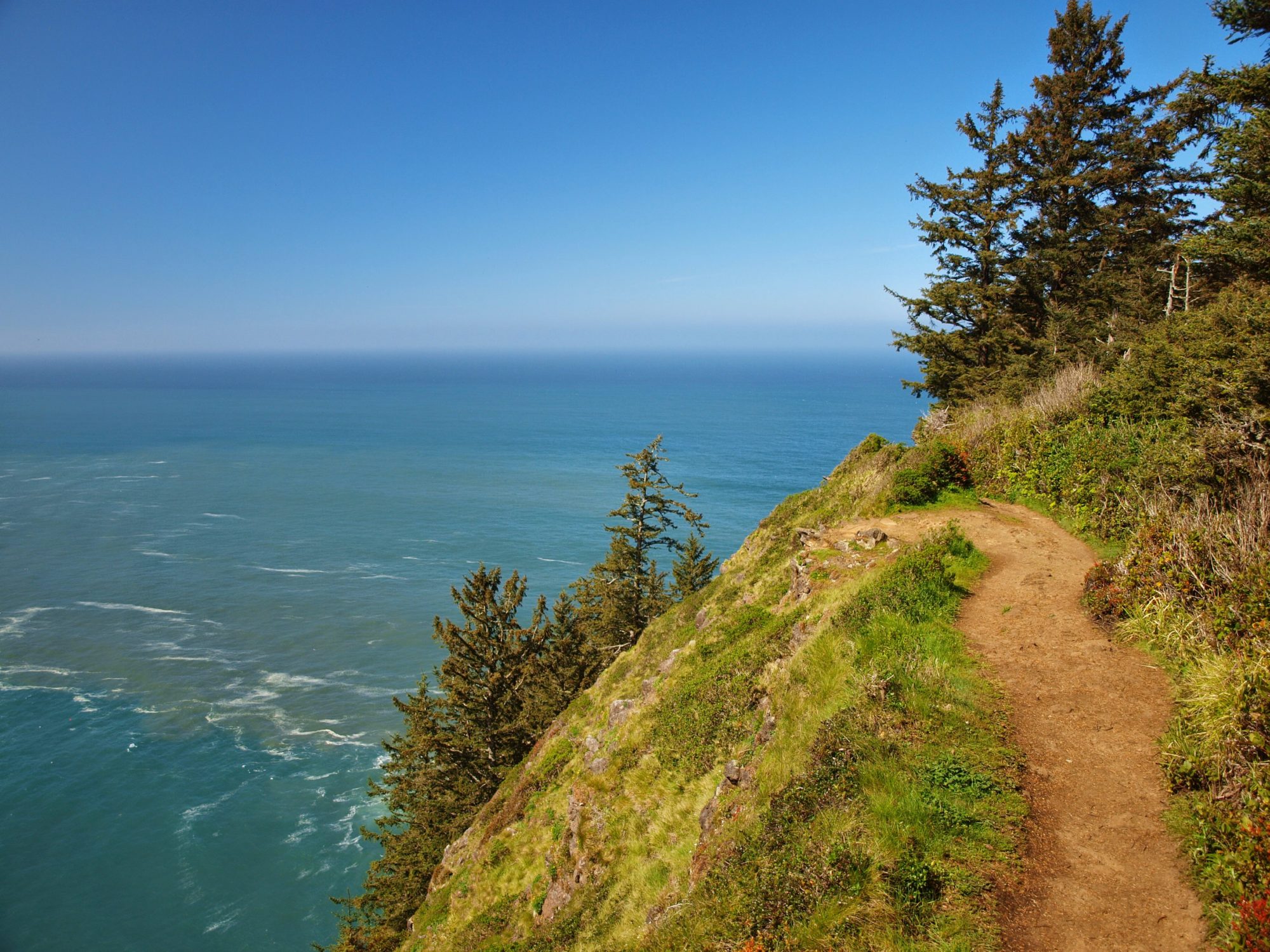
The north-end cape on the Three Capes Route, Cape Meares has a historic lighthouse, the famous Octopus Tree, and miles of trails overlooking the Pacific Ocean. It’s a great spot for whale watching.

Just north of Pacific City on the Three Capes Route is one of the Oregon Coast’s most popular state parks and campgrounds. Cape Lookout State Park offers beach, forest, trails, and camping – for RVs, tents, cabins, yurts – and is open year-round. Campsites fill quickly in summer, so be sure to make a reservation by calling 800-452-5687
Just a mile south of Cape Kiwanda, Bob Straub State Park is one of our “secret” beaches. Enjoy a big wide beach, trails for people and horses, the Nestucca River sand spit to explore (and maybe catch a fish), and it’s away from the crowds. Open year-round for day use. There’s room for horse trailers in the adjacent county parking lot.
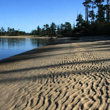
Just north of Tierra del Mar on the Three Capes Route, Sitka Sedge is the newest state natural area and a favorite of locals. Once part of a family farm, the area is rich with coniferous forests, wetlands, tidal flats, salt-water marshes, and beach views that go on for miles. Trails loop for 3.5 miles. Open year-round for day use.
Adjacent to Whalen Island County Park, this natural area is a nearly untouched coastal estuary ecosystem, bounded by the Sand Creek Estuary. Clay Myers is a wonderland of trails, beach and flora and fauna: woodlands, grasslands, fresh and saltwater wetlands, and native dune sedgeland; plus salmon, steelhead, deer, otter, elk, even cougar and bear. Open for day use year-round.
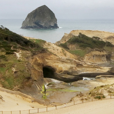
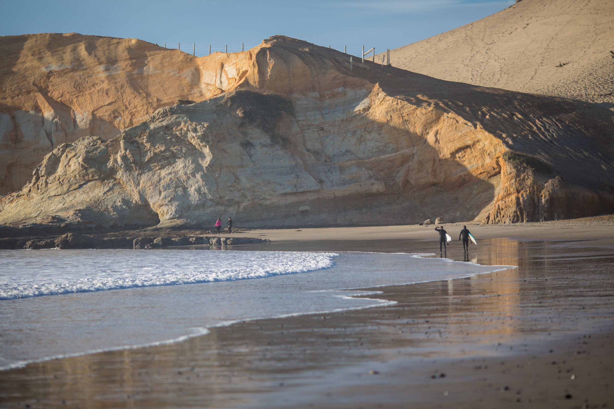
Located in the heart of Pacific City, this sandstone headland is one of the Three Capes Scenic Route capes. Cape Kiwanda’s steep dune leads to views of the ocean where you can watch the historic Dory Fleet boats grab a wave from the beach and launch into the ocean. After you slide down the dune, you nearly land in Pelican Brewing’s parking lot. Very convenient. Open year-round for day use.

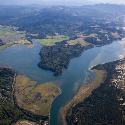
Between Pacific City and Neskowin, just off Highway 101, is the largest refuge within the Oregon Coastal Refuge system. Nestucca Bay Wildlife Refuge is located where the Nestucca and Little Nestucca rivers converge and flow into the Pacific Ocean. It is the winter home of six subspecies of Canada Geese as well as many species of ducks, shorebirds and raptors. It is a complex habitat of marshes, bogs, wetlands and meadows. Every season is filled with nature’s abundance. Open year-round.
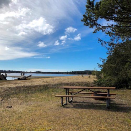
There’s a reason locals call this place “magical.” Quiet, forested and nearly surrounded by water, Whalen Island is the place to relax and take in nature at its best. Trails lead around the island, and there is plenty of fishing, crabbing, birdwatching and kayaking to keep you busy. Park has RV and tent sites, a boat launch, and is adjacent to Clay Myers State Natural Area. Open year-round.
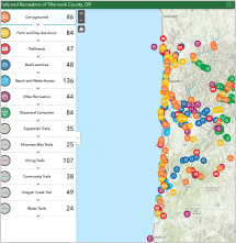
View the Tillamook County Trails & Recreation Map
From detailed trail information to campsites to picnic areas, this mapping tool will help you plan your next outing to our part of Oregon’s north coast.